Background
India shares a 15,106.7-km land border with seven countries. The nature of these borders varies considerably:
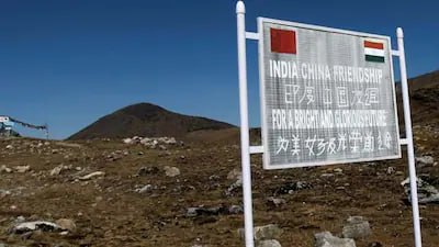
China: Mountainous terrain; several stretches remain difficult to fence, and the boundary remains undemarcated at various points.
Pakistan: Desert, plains and sensitive infiltration zones; increasing use of drones for smuggling and surveillance.
Bangladesh: Riverine and flood-prone stretches where conventional fencing is difficult.
Other borders include forests, mountains and densely populated areas, requiring different security approaches.
Traditionally, border management has relied heavily on:
Physical fencing
Border guarding forces
Patrolling
Surveillance infrastructure
Local intelligence
The government is now moving towards a technology-enabled, integrated border management model.
This is consistent with the four-pronged border-security strategy emphasised by the Union Home Ministry: Border guarding forces + Local population + State Police + Technology.
Features
Integrated surveillance
Inputs from cameras, sensors, drones and other surveillance equipment will be brought together on a common platform.
Unified command-and-control
Information from forward areas will flow through regional/field command centres to higher headquarters and Delhi.
AI-enabled monitoring
Artificial intelligence and image-processing technologies can help identify suspicious movement and patterns.
Reduced dependence on physical patrolling
Real-time surveillance could allow forces to concentrate personnel and resources where threats are detected.
Terrain-specific solutions
Technology will be customised according to the nature of each border rather than applying one solution everywhere.
Challenges
Diverse geography: Deserts, mountains, forests, rivers and populated areas require different technological solutions.
Technology cannot fully replace manpower: While surveillance can reduce routine patrolling, sensitive borders still require physical presence and human intelligence.
Cybersecurity: An interconnected command system could become vulnerable to cyberattacks, spoofing or manipulation of surveillance data.
Inter-agency coordination: Sharing real-time information between border forces, State police and intelligence agencies requires common communication and data systems.
False alerts: AI and automated surveillance may generate false positives or miss sophisticated threats, requiring human verification.
Cost and maintenance: Sensors, cameras, communication networks and command centres require substantial investment and regular maintenance, especially in remote areas.
Way Forward
India should adopt a “technology + human intelligence + local participation” model.
Develop terrain-specific solutions rather than a uniform system.
Strengthen anti-drone capabilities.
Integrate databases and communication systems of different security agencies.
Build strong cybersecurity safeguards.
Use AI as a decision-support system, not as a complete replacement for human judgement.
Continue using local communities as an intelligence and surveillance resource.
Train border personnel to operate and interpret advanced surveillance technologies.
Test the Pakistan-border pilot thoroughly before scaling it up nationally.
Conclusion
The project signals a shift from the traditional concept of border security to border management through technological means. In terms of the diverse geography of the Indian borders, fence building and physical patrols would not be sufficient for border security. Instead, a mix of AI, sensors, drones, command centres, human intelligence, and participation from local people would lead to an effective border security mechanism.