Background
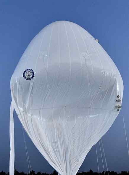
HAPS (High-Altitude Platform Systems) are aerial platforms designed to operate in the stratosphere, generally at around 20 km altitude.
They are intended to provide persistent surveillance and communication for long durations.
The platform was developed by DRDO's Aerial Delivery Research and Development Establishment (ADRDE), Agra.
It is a lighter-than-air system, unlike conventional aircraft.
HAPS can potentially complement satellites, aircraft and drones.
Features
Operating altitude: Around 20 km in the stratosphere.
Long endurance: Designed for prolonged aerial operation.
Surveillance role: Can provide continuous monitoring over large areas.
Inertial Measurement Unit (IMU): Helps determine movement, orientation and position.
GPS receiver: Provides navigation and positioning.
Onboard cameras: Enable aerial surveillance and observation.
Altitude-control mechanism: Helps maintain the required operating altitude.
Indigenous technology: Strengthens domestic defence manufacturing and technological capability.
Strategic Significance
HAPS can act as a bridge between drones/aircraft and satellites.
Potential applications:
Border and maritime surveillance
Intelligence, Surveillance and Reconnaissance (ISR)
Communication relay
Monitoring of remote and strategically sensitive areas
Disaster management and emergency communications
Persistent observation during military operations
Challenges
Low air density: At high altitude, reduced atmospheric density makes flight and control difficult.
Extreme conditions: Stratospheric temperatures and winds pose engineering challenges.
Energy requirements: Long-duration operation requires highly efficient power systems.
Stability and control: Maintaining a fixed position and altitude is difficult.
Payload limitations: Surveillance equipment must be carried without compromising endurance.
Communication: Reliable long-range communication systems are required.
Way Forward
Increase the platform's flight endurance and operational reliability.
Improve payload capacity for advanced surveillance sensors.
Develop better autonomous navigation and altitude-control systems.
Integrate HAPS into India's broader border-surveillance and ISR network.
Explore applications in communication, disaster management and environmental monitoring.
Promote greater participation of Indian PSUs, private industry and start-ups in HAPS technology.
Conclusion
A successful trial of HAPS marks a major stride towards the development of India's high-altitude and long-endurance aerial system capability. This would help in providing surveillance and communications while supporting satellites, planes and drones. It also helps in achieving the objective of a self-reliant India in military technology.